


-
ForeCASTS

The maps in this atlas forecast future suitable habitat for North American forest tree species under two climate change…
-
EDDMaps: Early Detection and Distribution Mapping System

EDDMapS is a web-based mapping system for documenting invasive species and pest distribution.
-
Water Supply Stress Index (WaSSI) Ecosystem Services Model

The Water Supply Stress Index Model (WaSSI) is a web-based tool that can be used to project the effects of land use…
-
Global Reservoirs and Lakes Monitor (G-REALM)

G-REALM is a program that uses satellite data to routinely track water levels of major lakes and reservoirs around the…
-
GIMMS Global Agricultural Monitoring

The Global Agricultural Monitoring (GLAM) system allows you to view satellite images showing the health and greenness…
-
Global Farm Animals Ration Programs

GlobalFARP can help small-scale producers by offering ration programs in their local languages and optimizing least…
-
COMET-Planner Global
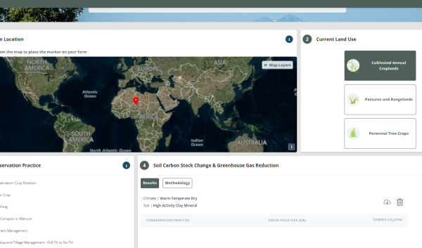
The tool allows people around the world to zoom into a map, place a marker in their region, select their current land…
-
Soil and Water Assessment Tool

The Soil & Water Assessment Tool is a small watershed to river basin-scale model used to simulate the quality and…