Reading Time: 10 minutes

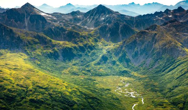
Southeast Alaska, roughly equivalent in size to Indiana, is a rugged and remote landscape. It is home to the highest salmon abundance in Alaska, some of the largest glaciers in the U.S., and the world’s largest temperate rainforest. The region is characterized by a narrow mainland strip of mountains and ice fields, complemented by over 1,100 densely forested islands. Elevations rise sharply from sea level to heights exceeding 10,000 feet.
The climate across Southeast Alaska varies significantly because of its diverse terrain and unique island ecosystems. However, the entire region is experiencing rising temperatures, more frequent and severe drought, changes to precipitation and snowpack, shrinking glaciers, and extended growing seasons associated with climate change. These changes can have profound effects on natural and cultural resources, human life and infrastructure, and wildlife. By understanding these changes, land managers and the public can increase the adaptability of our ecosystems and communities.
Rising Temperatures
Rising temperatures have a direct influence on most of the effects of climate change in Southeast Alaska and have cascading effects on ecosystems in the region. Annual average temperatures in the region have increased by 2.4°F since 1971. By the end of the century, temperatures are projected to increase by 6–10°F relative to the 1970–1999 period.
Changes to Precipitation
Southeast Alaska is known for its abundant precipitation. Rainfall, snowfall, and the timing of snowmelt affect the types of animals and plants that can survive in the region, and the availability of surface water and groundwater for communities, commerce, and wildlife. On average, the region receives 154 inches of precipitation per year, but precipitation varies significantly across the region, from 29 inches per year in Skagway to 235 inches in Little Port Walter. As average temperatures rise, more evaporation occurs. This leads to greater overall precipitation. Since 1957, precipitation has increased slightly across most of Southeast Alaska, but remains within historical year-to-year variability. However, precipitation in the Central Panhandle has increased by a substantial 15%.
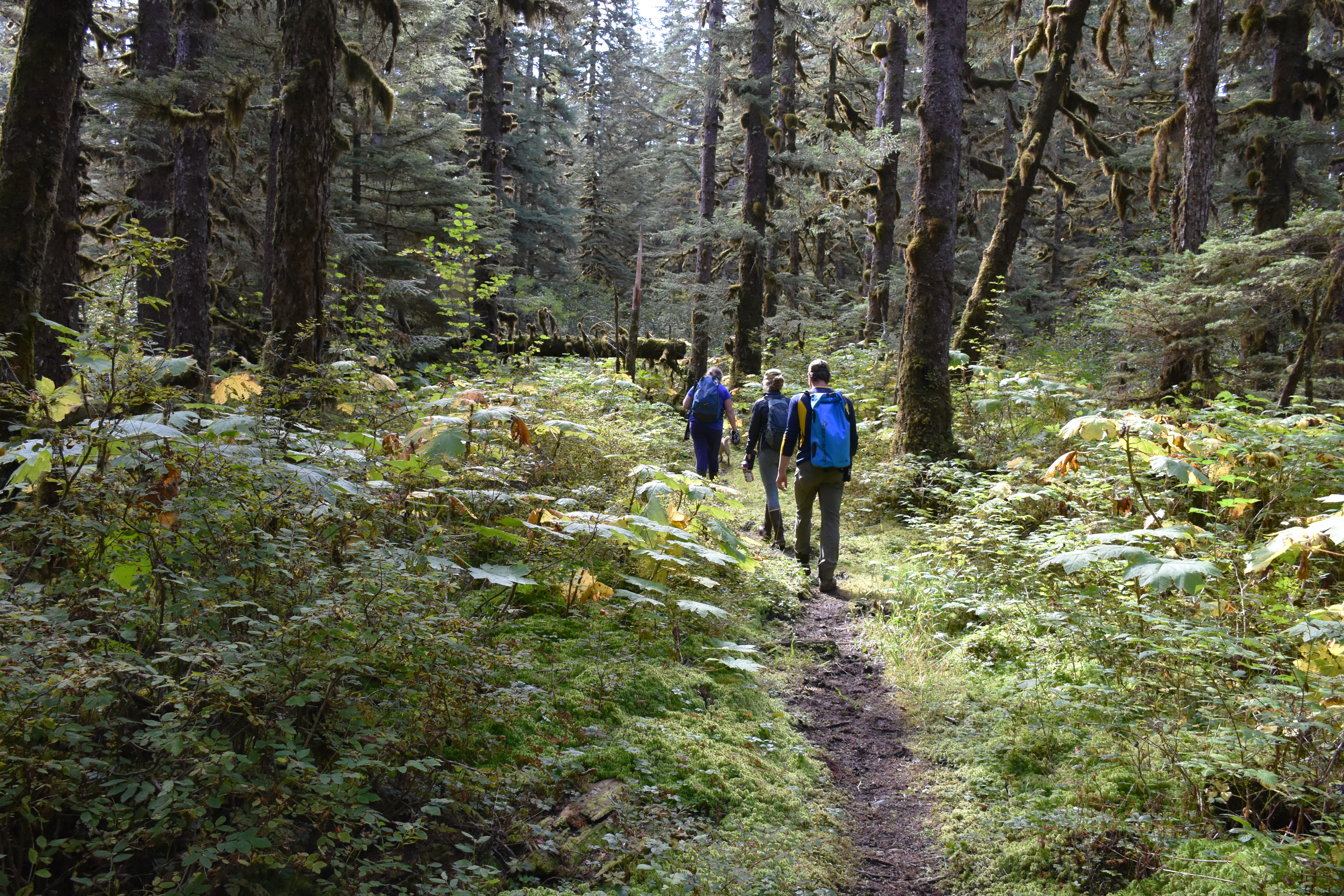
Annual precipitation is projected to increase by the end of the century. However, this may not translate to consistent water availability throughout the year. In fact, late spring and early summer are expected to experience significant drying. Warmer temperatures are a contributing factor, as they are likely to cause more precipitation to fall as rain rather than snow. Earlier snowmelt and runoff will lead to earlier drying of soils and vegetation. This could reduce the amount of water in streams and elevate water temperatures, with impacts on plants during the growing season and aquatic species (e.g., salmon) that rely on healthy stream habitat.
Extreme precipitation events are projected to increase in Alaska by the end of the 21st century. These events, which include atmospheric rivers and floods, have caused significant damage in recent years. Atmospheric rivers in Southeast Alaska are common. In fact, they affect the region from 8 to 15 days a month. But these events are becoming more severe as the climate changes, with an increasing potential to damage infrastructure and communities in the region. For example, in December 2020, an atmospheric river caused record-breaking precipitation across the region. The storm triggered deadly landslides and flooding, resulting in two fatalities and $33.5 million in public property damage.
Snow
Snowpack stores water in the winter. As the warm season arrives, rising temperatures melt snow, releasing runoff. As temperatures rise with climate change, more precipitation will fall as rain rather than snow, especially at lower elevations (below 3,280 feet). By mid-century, snow water equivalent (the amount of water in the snowpack, or SWE) is projected to decrease in Southeast Alaska. Areas below 820 feet are expected to see the largest reductions in SWE—44% by the mid-2050s. Snowfall is likely to remain the dominant form of precipitation above 5,000 feet.
Changes to snowpack have already caused a decline in Alaska yellow-cedar, one of the most ecologically, culturally, and economically important tree species in the region. Snowpack insulates the cedar root systems from cold air temperatures. With reductions in snowpack, frosts and early snowmelt can damage or kill shallow-rooted yellow-cedar.
Drought
Although precipitation is expected to increase in Southeast Alaska, climate change is also projected to cause more frequent and impactful droughts. Increases to the frequency of these events have already occurred, with the most recent example being a severe drought from 2016 to 2019. This multi-year drought caused a significant decline in water levels of lakes and reservoirs, prompting water restrictions and the costly switch from hydropower to diesel generators in some communities. The drought also played a role in a massive hemlock sawfly outbreak. Typically, cool and wet summers keep hemlock sawfly populations in check, but dry conditions facilitated a population boom that led to the defoliation of over 500,000 acres of forest from 2018 to 2020.
While wildfires are uncommon in the temperate rainforest, drought can elevate the risk of wildfires and smoke exposure in Southeast Alaska. For instance, in July 2019, smoke from fires in surrounding regions significantly degraded air quality and visibility. Residents reported unusual levels of smoke, with several days of dense smoke blanketing Juneau, a rare event for the region.
Melting Glaciers
Rising temperatures and changes to precipitation are causing glaciers in Alaska to melt at some of the fastest rates on Earth. In Southeast Alaska, total glacial volume is expected to decrease by 26% to 36% by the end of the 21st century. Glaciers act as reservoirs, storing snow and ice in the winter that melt and replenish waterways throughout the warm season. As glaciers retreat, their contribution to streamflow will decrease. These changes can disrupt the natural cycle that sustains entire ecosystems, both on land and in the ocean.
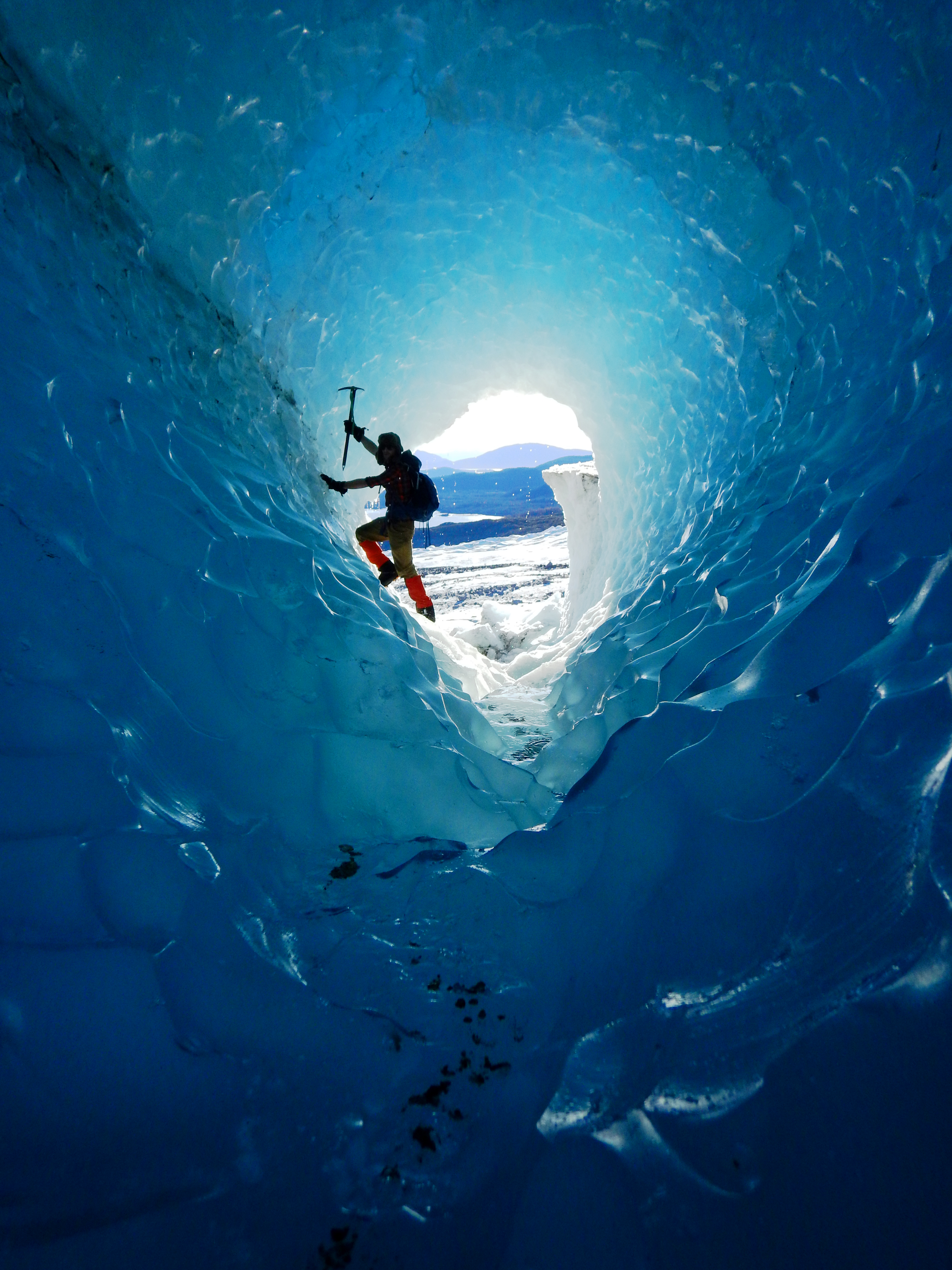
Glacial melting can also threaten communities with direct impacts like flooding and landslides. For example, glacial lake outburst floods are rapid releases of water from a glacial lake caused by the sudden failure of an ice or rock dam. They can quickly inundate downstream communities, natural resources, and commerce. As glaciers continue to thin and recede, it is possible that these events will occur in new areas. Melting glaciers can also expose steep, unstable slopes that are prone to landslides. If landslides occur above deep ocean water, they pose a significant risk of triggering tsunamis. In October 2015, such a scenario occurred at Tyndall Glacier in Southeast Alaska. The retreat of the glacier exposed a steep slope next to deep water in Taan Fjord. The unstable slope collapsed, sending 180 million tons of rock into the fjord, and causing a tsunami wave that reached heights of 633 feet, one of the highest tsunami runups ever documented. Events like this could occur more frequently as glaciers recede.
Melting glaciers in Southeast Alaska will also contribute to global sea level rise. In the southern reaches of Southeast Alaska, communities like Metlakatla could experience a 1 ft rise in sea level by 2108. However, sea level rise is not uniform and some areas in the region may experience a decrease in sea level in a process known as isostatic rebound. As glaciers melt and recede, their massive weight is reduced. This causes the elevation of the land to rise (or rebound). Some areas in the region (e.g., Juneau) could experience around 3.9 feet of additional land-surface uplift by 2100 because of isostatic rebound.
Tourism is a vitally important economy in the region and could be significantly affected by glacial retreat. For example, the Mendenhall Glacier Visitor Center on the Tongass National Forest is the most visited attraction in Alaska, with one in every three visitors to the state traveling there. In 2017, 700,000 people visited the area. However, by 2050, the Mendenhall Glacier is expected to recede from the view of its namesake visitor center. How this will affect site visitation remains to be seen. Tourists may continue to visit the area, but cruise ships may concentrate in other locations where glaciers are still visible.
Hydropower generation contributes significantly to regional energy and is also affected by thinning and receding glaciers. Initially, melting glaciers may generate increasing annual runoff, which could benefit hydropower generation. Eventually, however, this runoff will reach a peak and then decline as the glacier retreats. Less water in reservoirs reduces hydropower output and can increase the cost of water and power. Yet, in some areas, glacial melting will open up new or expanded hydropower opportunities, at least in the short term. To maintain regional energy resilience, it will be important for communities to diversify their energy streams and consider long-term use and efficacy of hydropower sites.
Ocean Warming and Acidification
Many people who live in Southeast Alaska rely on marine habitats for food, recreation, and cultural practices. The region boasts nearly 19,000 miles of shoreline and some of the richest marine waters in the country. However, by 2080, sea surface temperatures in the Gulf of Alaska are projected to increase by 5.4°F compared to the historical average (1976–2005). This warming could significantly disrupt marine food webs and the relationship between people and marine habitats, potentially mirroring the effects of the 2013–2016 marine heatwave ("the Blob"). Coinciding with a strong El Niño event, the Blob greatly reduced numbers of commercially valuable fish species like walleye pollock, Pacific cod, and Pacific sand lance. Marine birds and mammals also suffered, with record die-offs of common murres, high sea lion mortality, and an unusual number of whale deaths. As ocean temperatures continue to rise, "the Blob" serves as a possible glimpse into the future of Southeast Alaska's marine environments.
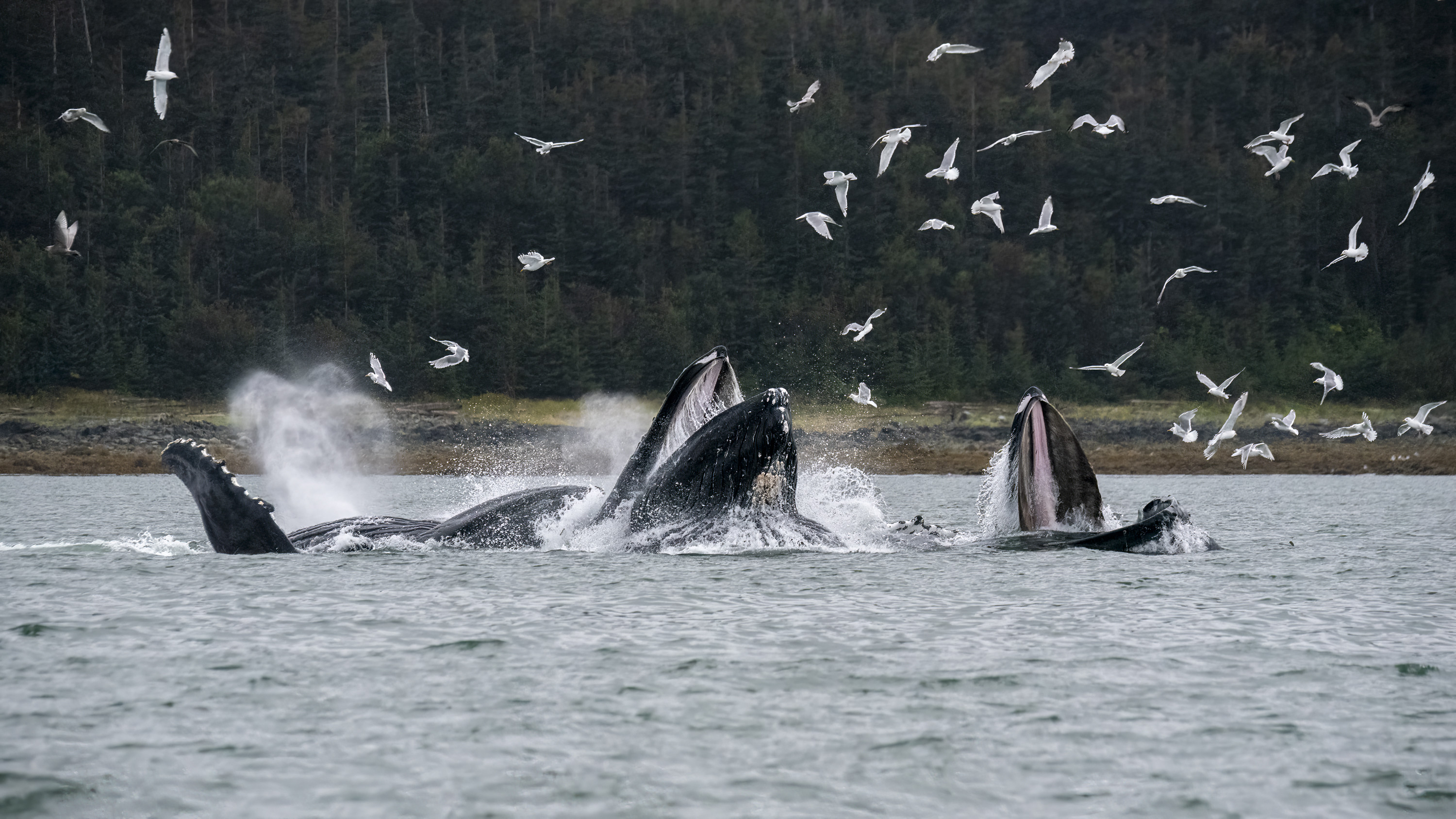
Adding to rising temperatures, the Gulf of Alaska also faces increasing ocean acidification. Increased acidity has several consequences for marine life. It disrupts the natural balance of chemicals needed by organisms to build their shells and skeletons (made of calcium carbonate). This can harm creatures like shellfish and plankton. Shell-building organisms like oysters and clams are particularly vulnerable. Red king crab, sea snails, and pteropods (sea slugs) are also negatively affected. For some species of salmon, acidification reduces the ability to evade predators, find food, and navigate back to their spawning grounds. Because communities in Southeast Alaska are heavily reliant on fishing for their food security and livelihoods, these impacts increase the risk of economic hardship and food insecurity.
Expanding adaptation in Southeast Alaska
Adapting to climate change in the region requires a multi-faceted approach. Expanding protected areas and restoring vital terrestrial and marine habitats (e.g., forests, streams, kelp forests) can create sanctuaries for vulnerable species and bolster the health of regional food webs. Using best timber management practices and transitioning old-growth timber harvest to young-growth harvest can help to maintain carbon stores, reduce erosion, and maintain water quality and habitat for fish and wildlife.

To prepare for extreme events in communities (e.g., floods and storms), localized detection and warning systems can allow precious time to prepare and evacuate. For example, the community of Craig is installing a network of rain gauges to provide an early-warning detection system for landslides. Planning infrastructure with climate change in mind can also increase the adaptability of communities. Relocating roads away from floodplains or steep slopes can reduce flood damage, and upsizing culverts and bridges improves the ability of high water to move through without damage. Improving building energy efficiency and resilience to extreme storms will also contribute to safer, more resilient communities.
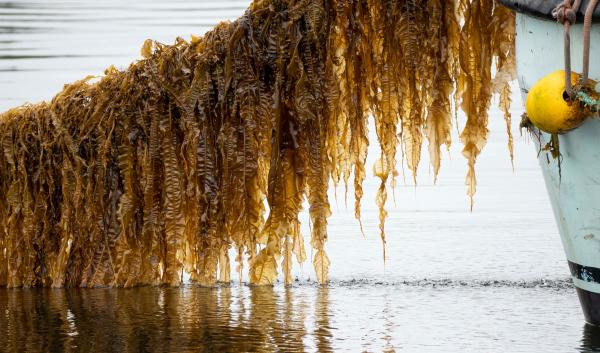
The livelihoods and cultures of Southeast Alaska are at stake in a changing climate. Supporting economic diversification in coastal communities can lessen dependence on potentially vulnerable fisheries. For example, some communities are turning to seaweed farming to diversify economies and employ workers accustomed to marine environments. As temperatures rise, emerging agricultural opportunities could help communities improve food security and diversify economies.
Finally, ongoing research and collaboration will continue to be important. Monitoring of climate impacts and exploration of potential solutions are crucial for effective adaptation. Incorporating traditional ecological knowledge into adaptation strategies can lead to more holistic solutions. In addition, sharing best practices and resources among communities in Southeast Alaska and beyond strengthens collective resilience. Though climate change threatens the region’s natural resources, cultural practices, and economic well-being, communities can take steps to adapt and build resilience for the future.
Adapt Alaska is a website that helps Alaskan communities build resilience to climate change through exploring changes, planning, and finding resources.
Sustainable Southeast Partnership is an organization dedicated to sustainability that supports Southeast Alaska communities in achieving their goals for community well-being, prosperity, and environmental health.
The Alaska Coastal Rainforest Center builds partnerships and catalyzes collaborative ecological, economic, and social research in the north Pacific coastal temperate rainforest to support vibrant and resilient communities and ecosystems.
Juneau’s Changing Climate & Community Response is a report that summarizes the impacts of climate change on the Juneau area, and the various ways in which the community is adapting to and mitigating those impacts.
Alaska Garden Helper is a tool that helps individuals explore changing growing conditions in their communities.
Arctic Environmental and Engineering Data and Design Support System is a tool that provides easily obtainable, well-vetted, and reliable engineering and environmental data designed to meet the needs of engineering professionals.
Community Climate Charts is a tool that allows individuals to see temperature and precipitation projections through 2099 for over 3,800 communities in Alaska and western Canada.
Arctic Environmental and Engineering Data and Design Support System is a tool that explores projected maximum precipitation events, temperature, and permafrost effects by specific location across Alaska.
Northern Climate Reports is a tool that provides community-level climate reports, including information about future temperatures, precipitation patterns, wildfire probability, and more.
Tongass National Forest's Subsistence Maps – This website provides information to the public on salmon monitoring projects, wildlife special actions, and deer harvest regulations coming from the Tongass National Forest's Office of Subsistence Management.


