This webpage compiles datasets and decision-support tools available for land managers and natural resource professionals that help with assessing the conditions of a landscape for planning purposes. This list is not exhaustive of all resources; it focuses on data and tools available to the public, with an emphasis on resources available within the state of California.
NOTE: If you know of any resources relevant to California’s forests and shrublands that are not on this list, please contact California Climate Hub Coordinator Jess DellaRossa.
-
Regional Resource Kit California Landscape Metrics
Purpose: The California Landscape Metrics, a product of the California Wildfire and Forest Resilience Task Force Regional Resource Kits, is a database of high-quality, geospatial data layers that were curated by federal, state, and academic scientists. Metrics help land managers analyze current landscape conditions, evaluate trade-offs among management scenarios, and support collaboration through transparent data.
Format: Download geospatial data (.zip), a map of each metric (.jpeg), or metadata (.txt)
Geographic Area: Regional (Northern California, Southern California, Central Coast, and Sierra Nevada regions) or Statewide
Intended Users: Resource managers, landowners, and the public
California Natural Resources Agency Open Data
Purpose: The California Natural Resources Agency Open Data platform provides several datasets, which are categorized by topic: Oceans, Water, Wildlife, Land Management, Energy, Conservation, Climate, Natural Hazards and Recreation. Users can also search for key words to discover accessible datasets.
Format: Varies by dataset (can include .csv, .zip, .gdb, .shp, .html, GeoJSON)
Geographic Area: Varies by dataset
Intended Users: Resource managers, landowners, and the public
Wildfire Risk to Communities
Purpose: This website contains information on wildfire risk, how to reduce wildfire risk to communities, and maps and charts for the user to explore. This is the second edition of Wildfire Risk to Communities across the United States and is published by the USDA Forest Service. Users can explore wildfire risk to a specific county, community, state, or tribal area and learn about reducing wildfire risk depending on their role. The following data can be downloaded: Risk to Potential Structures, Conditional Risk to Potential Structures, Exposure Type, Burn Probability, Conditional Flame Length, Flame Length Exceedance Probability, and Wildfire Hazard Potential.
Format: Tabular data (.csv, .txt, and .xlsx) and GIS data (.tiff, .shp, .gdb)
Geographic Area: Statewide or Nationwide
Intended Users: Land managers, elected officials, planners & developers, emergency services, homeowners, fire collaboratives, and health & social services
-
A decision-support tool is a science-based resource that quickly analyzes and evaluates large amounts of spatial, quantitative, and qualitative data to provide potential management options. Fundamentally, decision-support tools help stakeholders make data-informed decisions.
Planscape
Purpose: Planscape is a free, open-source decision-support tool that allows users to access and quickly visualize the Regional Resource Kit California Landscape Metrics data without a Geographic Information System. This tool helps regional planners assess current landscape conditions and weigh tradeoffs of landscape treatments to mitigate fire risk and maximize ecological benefits.
Format: Web-based application
Geographic Area: Regional (Southern California, Northern California, Central Coast, and Sierra Nevada regions)
Intended Users: Resource managers, landowners, and the public
ForSys
Purpose: ForSys is a spatially explicit model that was created by scientists at the USDA Forest Service’s Rocky Mountain Research Station. The model helps users to explore management scenarios and optimize decisions about where and how to carry out activities to achieve landscape-scale restoration or fuel management goals. ForSys quickly analyzes large amounts of data to assist in understanding costs and benefits of selecting one project versus another.
Format: Windows desktop version (ForSysX) or R (ForSysR)
Geographic Area: All spatial shapefiles
Intended Users: Resource managers
Region 5 Broader-Scale Monitoring
Purpose: This webpage developed by the USDA Forest Service allows users to view findings by topic and by National Forest from the agency’s Region 5 (California) monitoring strategy. Results from monitoring efforts can help managers adapt to identified vulnerabilities and ensure management objectives are being met.
Format: Online application
Geographic Area: National Forests or provinces across California
Intended Users: Land managers
California Wildfire Data Explorer
Purpose: This tool displays interactive maps of wildfire hazard and risk, historical fire information, administrative boundaries and fuel treatment locations across California. This tool can be viewed in “basic” view without an account, or in “advanced” view after applying for an account. The CAL FIRE Data Explorer allows users to investigate wildfire issues across the state.
Format: Online application
Geographic Area: California
Intended Users: Homeowners, landowners, emergency managers, natural resource professionals, land managers, and wildland fire responders
Interagency Treatment Dashboard
Purpose: The California Wildfire and Forest Resilience Task Force created this dashboard to compile information about forest and wildland projects completed or planned by federal and state agencies, and private industry from 2021-2023. The interactive tool allows users to sort treatments by region, county, land ownership, and treatment activity. This interactive dashboard is helpful to guide practitioners on where to plan new projects by looking back at recent projects in the area.
Format: Online tool
Geographic Area: California
Intended Users: Homeowners, landowners, natural resource professionals, and land managers
Forests to Faucets 2.0
Purpose: USDA Forest Service scientists analyzed and compiled information about watersheds that are most important to surface drinking water and potential threats to those watersheds. The maps found in this data explorer can be incorporated into planning and to identify vulnerable watersheds. The data stored in this tool help users identify watersheds of interest for conservation and management.
Format: Geospatial data and online data explorer tool
Geographic Area: United States
Intended Users: Land owners, land managers, water authorities, educators, natural resource professionals, surface water consumers
-

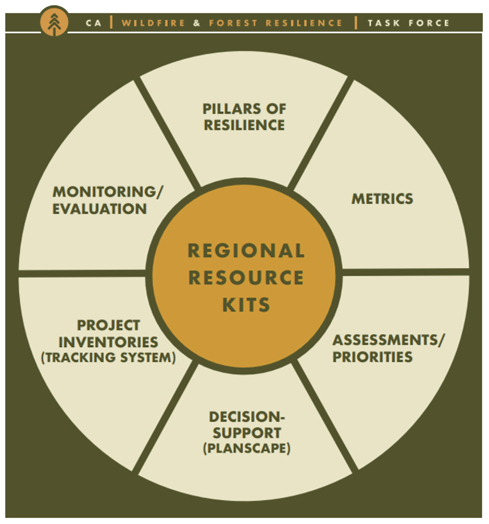
The California Wildfire and Forest Resilience Task Force’s Regional Resource Kits assemble tools and data that local, state, tribal, and federal land managers can use to support the planning, implementation, and monitoring of their projects across California to improve forest or shrubland conditions and reduce wildfire hazard. The following factsheets provide a succinct overview of the Regional Resource Kit products and their utility for land managers.
Regional Resource Kits 101
Pillars of Resilience
Planscape
California Landscape Metrics

